Remote Sensing Satellite Launch: Pakistan Set to Boost Space Capabilities in 2025

Pakistan is set to achieve a major milestone in its space exploration journey with the upcoming Remote Sensing Satellite Launch scheduled for 2025. This significant development will not only showcase the country’s growing technological capacity but also offer practical solutions in sectors such as agriculture, disaster management, and national security. Under the supervision of SUPARCO (Space and Upper Atmosphere Research Commission), the satellite project is a crucial step in realizing the goals set under the National Space Program 2047.
What Is a Remote Sensing Satellite?
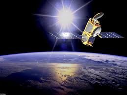
A Remote Sensing Satellite is a space-based instrument designed to monitor and collect data from Earth’s surface using sensors. These sensors can operate in various spectrums such as visible, infrared, and microwave, providing comprehensive data irrespective of weather conditions. The information gathered plays a vital role in a wide range of applications, from climate monitoring to natural resource management.
Pakistan’s decision to pursue a Remote Sensing Satellite Launch highlights its aim to become self-reliant in collecting critical data without depending on foreign satellite sources. This satellite will deliver high-resolution imagery that can be used by multiple government departments and research institutions across the country.
Strategic Significance of the Remote Sensing Satellite Launch
The Remote Sensing Satellite Launch is not just a technological project; it holds strategic importance for the nation. With increasing challenges such as climate change, flooding, and urbanization, having a dedicated satellite will allow Pakistan to monitor environmental and geographical changes in real time. The ability to predict natural disasters like floods or droughts will greatly enhance preparedness and response efforts.
Furthermore, the launch will provide a reliable and continuous source of satellite imagery, which can be used for national defense, border surveillance, and urban planning. This aligns with global trends where space-based assets have become essential for securing national interests.
Economic and Developmental Benefits
The economic advantages of the Remote Sensing Satellite Launch are extensive. For agriculture, satellite data will enable farmers to analyze crop conditions, monitor irrigation needs, and detect pests or diseases early. This can significantly boost crop yield and reduce losses, supporting the country’s agrarian economy.
Urban development authorities can use the satellite data for planning infrastructure projects, identifying unauthorized constructions, and managing traffic congestion. Environmental departments will benefit from monitoring deforestation, water resources, and air pollution levels with greater accuracy and frequency.
Additionally, the satellite will open new opportunities in the private sector. Technology startups and GIS-based companies can utilize open satellite data for developing commercial solutions, thus contributing to job creation and technological innovation.
SUPARCO’s Role and National Space Vision
SUPARCO has been at the forefront of Pakistan’s space exploration efforts. With the Remote Sensing Satellite Launch, the organization is demonstrating its growing capabilities in satellite design, development, and integration. Engineers and scientists involved in the project are working in compliance with international standards, ensuring that the satellite meets reliability and quality benchmarks.
The satellite launch also falls under Pakistan’s National Space Program 2047, which aims to establish a robust space infrastructure for the country. This long-term vision includes launching communication satellites, building ground control systems, and fostering international partnerships for space research and development.
International Collaboration and Technological Exchange
While the Remote Sensing Satellite Launch is primarily a national effort, Pakistan is also exploring international cooperation to enhance its capabilities. Collaborations with space agencies from China, Turkey, and Russia are being considered to gain access to advanced technologies and training programs. These partnerships will help Pakistani engineers and scientists stay updated with the latest developments in aerospace technology.
Through shared missions and technical assistance, Pakistan can fast-track its progress in space exploration and satellite applications. Moreover, these collaborations may pave the way for future joint ventures in deep space exploration, satellite constellations, and space-based communication systems.
Educational Impact and STEM Development
The Remote Sensing Satellite Launch has significant implications for the education sector in Pakistan. Universities and research institutions will have access to locally sourced satellite data for academic studies, research projects, and technical training. This access will strengthen Pakistan’s academic and scientific communities by encouraging STEM (Science, Technology, Engineering, and Mathematics) education.
Students in aerospace engineering, geoinformatics, and environmental science will benefit from real-world applications of satellite data, leading to innovation and talent development. SUPARCO is also expected to initiate internships and fellowships to involve young minds in future space projects.
Public Awareness and National Pride
The announcement of the Remote Sensing Satellite Launch has sparked a wave of enthusiasm across the country. Social media users, educators, and professionals have praised the government’s efforts to advance in the space domain. It has also triggered discussions about the need for continuous investment in science and technology.
Such initiatives create a sense of national pride and inspire future generations to pursue careers in science and research. As the launch date draws closer, more awareness campaigns are expected to engage the public and highlight the benefits of remote sensing technology.
Challenges and Future Outlook
Despite the optimism, the Remote Sensing Satellite Launch comes with its own set of challenges. Technical hurdles, funding limitations, and geopolitical dynamics can affect the timeline and scope of the project. However, the commitment shown by SUPARCO and the government indicates that these challenges are being actively addressed.
Looking ahead, Pakistan plans to expand its space program further with additional satellite launches and technological upgrades. These efforts will ensure that space-based solutions become an integral part of the country’s infrastructure and governance systems.
Conclusion
The Remote Sensing Satellite Launch marks a pivotal moment in Pakistan’s journey toward space technology and innovation. It holds the promise of transforming various sectors, from agriculture and urban development to defense and disaster management. By leveraging the full potential of remote sensing technology, Pakistan is setting the foundation for a smarter, safer, and more self-reliant future.
As the world becomes increasingly dependent on space-based data, Pakistan’s entry into this domain with its own Remote Sensing Satellite Launch is both timely and essential. It is not just a technological achievement, but a declaration of the country’s readiness to embrace the future.


